Editor’s Note: This story has been updated to add additional information.
Google Maps is one of the world’s most popular online mapping systems — a powerful tool used for navigation and research purposes. Its Street View feature allows users to wander the streets of cities and towns around the world without ever leaving home.
JOIN US ON TELEGRAM
Follow our coverage of the war on the @Kyivpost_official.
But on several streets in the Ukrainian city of Kryvyi Rih, the hometown of President Volodymyr Zelensky, Street View abruptly goes black, preventing users from seeing anything but the name of the street that they are on.
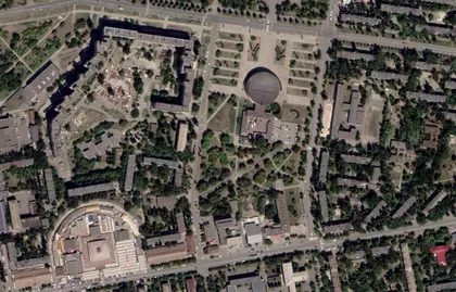
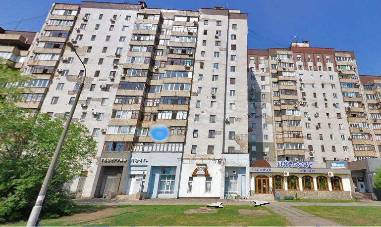
The “black zones” are located on the road where Zelensky’s parents live in a large, high-rise housing complex and along another nearby street.
The exact reason for the blackout is unclear, but it raises an obvious question: Is it a security measure taken by the Ukrainian government?
Tech giant Google has blurred or pixelated sites on its maps at the request of governments. It also allows ordinary people to request that their house not be shown in Street View. However, usually Google Maps simply blurs the house or its address plate, and does not black out the area.
Dmytro Sholomko, Google’s country director in Ukraine, said he did not know whether the company blocks sites on its mapping service at the request of the Ukrainian authorities.
“I don’t have access to this information,” he said. “The request of the Ukrainian authorities goes straight to California, to the U.S. I’m not a part of this process.”
The Kyiv Post reached out to Google’s U.S. press office, but has not yet received a response.
Zelensky’s parents
Zelensky’s parents, Oleksandr and Rymma, live near the center of Kryvyi Rih, a city of 635,000 people in Dnipropetrovsk Oblast, some 400 kilometers south of Kyiv.
Oleksandr Zelensky is a professor of informatics at Kryvyi Rih Institute of Economics. Rymma Zelenska is a retired engineer.
They live in a four-room apartment in a housing complex on Mystetska Street. The Kyiv Post is not publishing their address out of respect for their privacy, but it can be easily found through a minimal amount of online sleuthing in open phone and address databases.
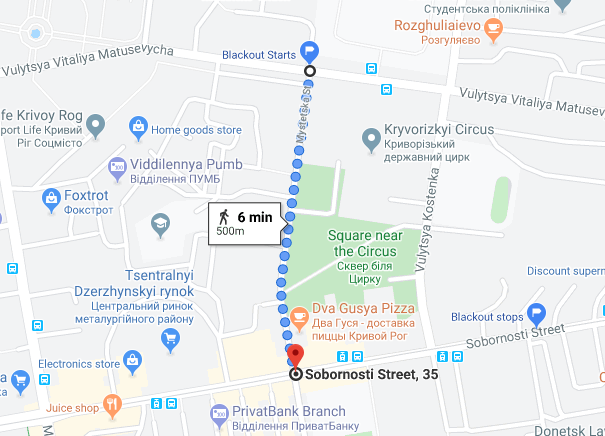
The entirety of Mystetska Street between Vitaliya Matusevycha and Sobornosti streets is blacked out on Google Street View. The blacked out section stretches for roughly 500 meters along Mystetska Street.
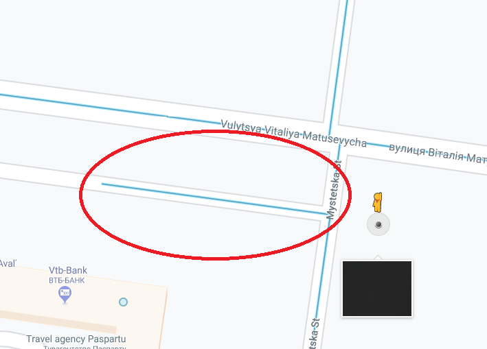
A small, unnamed street that breaks off from Mystetska and runs parallel to Matusevycha is covered by a short section of Street View. It is also blacked out. This road — likely for movement within the broader housing complex — runs past the building where First Lady Olena Zelenska’s family lived. Her parents now reportedly live in Kyiv.
A photo sphere in the first lady’s family’s building conspicuously does not work. Photo spheres are small blue circles on Google Maps that allows users to view panoramic, user-created images taken at that site. Several photo spheres in front of the president’s parents’ building do work.
Most surprisingly, 500 meters of the nearby Sobornosti Street heading east from Mystetska are also blacked out. This street is not adjacent to either family’s apartment, and is significantly larger than Mystetska.
In total, roughly 1,000 meters of streets are blacked out in this Kryvyi Rih neighborhood.
The blacked out sections of both Mystetska and Sobornosti streets are visible in the panoramic view mode of Yandex Maps, a Russian mapping system that is blocked in Ukraine. The Zelensky family’s apartment building is also fully visible.
What’s going on?
The location of the Zelensky family’s apartment is not a secret. Journalists have interviewed the president’s parents there and have published photos of the building.
In August, police searched the building after a state agency in Kyiv received a bomb threat against multiple buildings in the capital and the Zelensky family’s apartment complex in Kryvyi Rih. No explosives were ever discovered in the building, Radio Liberty reported.
A Kyiv Post source in the security agencies, who requested anonymity as he was not authorized to comment on this matter, said that such censorship of Google Maps could be possible. While he was not aware of the Ukrainian authorities requesting that Google black out sites on its maps, it would be plausible were it a measure to provide security to individuals under state protection.
The president is under state protection, and his parents could also be potential candidates for such protection.
The Kyiv Post checked other locations related to Zelensky on Google Maps: his apartment building on Hrushevsky Street near Mariinsky Park, one of the most expensive apartment complexes in Kyiv; his house in Pearl of Italy, an elite suburban housing development located seven kilometers outside Kyiv; and the Novoperchersk School his children attend in a high-end part of Kyiv. Not all of these places were available on Street View, but no efforts appear to have been taken to obscure Google Maps users’ ability to view the area.
Google has been known to censor buildings in Street View and to blur or black out birdseye satellite images of sensitive sites — nuclear power plants, military bases, etc. Individuals can also request that Google censor the image of their home in Street View. Still, usually this simply means that the house is covered in a blurred square in Street View.
The entirety of Israel and the Palestinian Territories is pixelated in satellite images in all mapping services due to U.S. legislation that forbids the U.S. government to grant liscenses allowing U.S. companies to collect higher-resolution satellite data of Israel than is available from foreign commercial sources. However, street view is widely available across Israel and in parts of the West Bank.
There is an entire Wikipedia page cataloging satellite map images that are blurred or missing data. According to it, several countries — particularly France, Greece and Spain — are quite active in having military bases, sensitive infrastructure and politically sensitive sites blurred on Google Maps satellite view.
In 2018, the Indian government rejected Google’s request to launch Street View in India. The government gave no explanation for its decision.
Aric Toler, a lead researcher at the open-source investigative unit Bellingcat, says he has never seen a case where Google censored an entire area in Street View by effectively turning it into a black void, but he suspects Google could do it.
Under normal circumstances, he would posit that such a blackout is a processing error. But when the location is potentially sensitive, that raises questions.
Toler says he is “torn 50/50” on whether the blackout is at the request of the Ukrainian government or “an innocent processing error, and low priority to fix or not noticed” because it is Kryvyi Rih, he told the Kyiv Post in a message.
Kirill Mikhailov, a researcher at the Conflict Intelligence Team who has significant experience using Google Maps for research, largely agreed with Toler.
In a message, he told the Kyiv Post he had seen such blackouts, but they were “never ostensibly censorship-related.” Still, he said he wouldn’t exclude that possibility.
You can also highlight the text and press Ctrl + Enter

